
Whole of Europe
Germany
( Page 1 of 7 )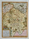
Thuringia Ortelius 1584
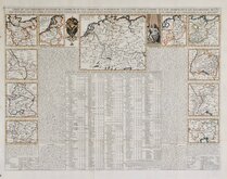
Henri Chatelain 1720
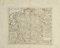
Westfalia Isaak Tirion 1740
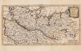
Upper Saxony Kitchin 1756
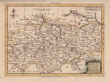
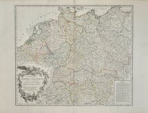
North Germany Kitchin 1756
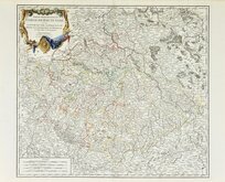
Haute Saxe Du Vaugondy 1757
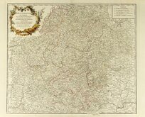
Franconia Robert De Vaugondy 1757
Empire Allemagne Robert de Vaugondy 1757


35x25 cm
SAXONY
Drawn by W.D.C.
BLACKIE & SON, GLASGOW
Published in The Imperial Atlas of Modern Geography Blackie & Son, London 1860.
The map was printed on the page adjacent to a map of Austria and has been crudely cut from the Austria map an re-margined to bottom edge. The map is clean and in original hand colour.
Quick Links


Eastern Europe & Turkey
Belgium & Luxembourg
×