
Belgium & Luxembourg
Germany
( Page 1 of 7 )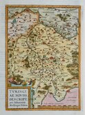
Thuringia Ortelius 1584
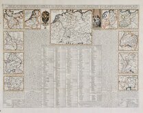
Henri Chatelain 1720
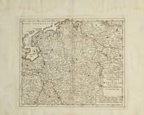
Westfalia Isaak Tirion 1740
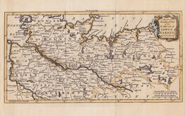
Upper Saxony Kitchin 1756
North Germany Kitchin 1756
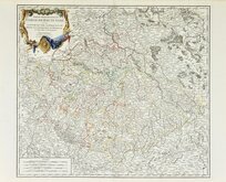
Haute Saxe Du Vaugondy 1757
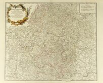
Franconia Robert De Vaugondy 1757
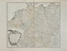
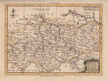
Empire Allemagne Robert de Vaugondy 1757

£95 Empire Allemagne Robert de Vaugondy
Ref: dsm4834
Add to
basket
Thanks,Your Product Has Been Added To Basket

57x48 cm
CARTE DE L'EMPIRE D'ALLEMAGNE divisé en ses dix cercles, dessinée d'aprés les Cartes Nationales assujeties aux observations astronomiques.
PAR LE Sr ROBERT DE VAUGONDY Géog? ord? du Roi, de l'Académie Royale des Sciences et Belles-Lettres de Nancy.
Avec Privilége 1756.
Published by Gilles Robert de Vaugondy (1688-1766) and hs son, Didier Robert de Vaugondy (1723-1786) in their greatest work, Atlas Universel in 1757.
Showing Germany divided into ten circles with states and duchies. The map extends from northern Italy to southern Denmark and from Belgium to western Slovakia, including Belgium, Netherlands, and parts of Switzerland, Liechtenstein, Austria, Czechnia, and Poland.
Three faint diagonal creases otherwise in very good condition with generous margins.
Quick Links

Whole of Europe

Eastern Europe & Turkey
×