
Eastern Europe & Turkey
Germany
( Page 2 of 7 )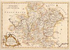
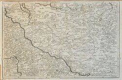
Franconia Rollos 1759
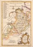
North Lower Saxony Rollos 1759
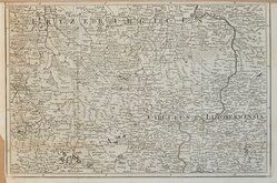
Westphalia Rollos 1759
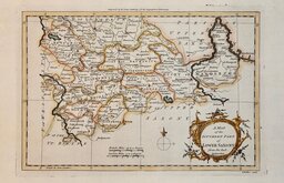
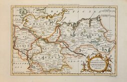
South Lower Saxony Rollos 1759
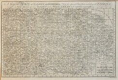
Saxony Bohemia Gibson 1760
Dresden Saxony Gibson 1760
Altenburg Saxony Gibson 1760

Lower Saxony Kitchin 1760


29x20 cm
Engrav'd (by the Kings Authority) for the Geographical Dictionary.
An ACCURATE MAP of the CIRCLE of FRANCONIA, Drawn from the best Authorities.
G. Rollos sculp.
Copper engraving by George Rollos published in A New Geographical Dictionary...by John Barrow. London, J. Cootes. 1759.
George Rollos (1731-1796) was apprenticed to engraver, cartographer and publisher, Thomas Kitchin (1719-1784). He seems to have remained a close friend and associate of Kitchin, following his move to St. Albans in 1780 and witnessing his will in that year.
Good clean example in neat hand colour.
Quick Links


Whole of Europe
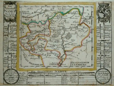
Belgium & Luxembourg
×