
Eastern Europe & Turkey
Germany
( Page 1 of 7 )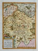
Thuringia Ortelius 1584
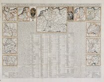
Henri Chatelain 1720
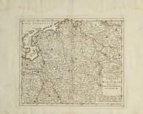
Westfalia Isaak Tirion 1740
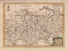
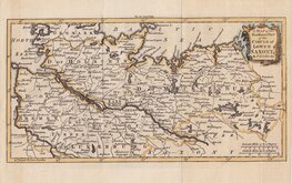
Upper Saxony Kitchin 1756
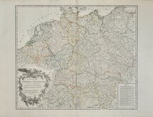
North Germany Kitchin 1756
Haute Saxe Du Vaugondy 1757
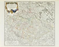
Franconia Robert De Vaugondy 1757
Empire Allemagne Robert de Vaugondy 1757


30x23 cm
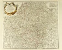
CARTE d'une partie de l'Allemagne Comprenant LA BAVIÈRE, LE WURTEMBERG ET LE G.D DUCHÉ DE BADE
Géographie moderne.
Gravé par Thierry. rue des Mathurins S.t Jacques N.o 1.
Steel engraving by Louis-Michel Thierry (fl.1810-1840) published in Geographie Moderne...C. Malte-Brun, Paris, 1839.
Conrad Malte-Brun (1775-1826) Born in Denmark, he became a political activist, was exiled in 1799 and moved to France beginning a carreer in geography and cartography and with French geographer Edme Mentelle produced Geographie mathematique, physique et Politique...1803-1812. He became known as one of the leading French cartographers of his time and died in Paris in 1826 while drafting the final version of his major 8 volume work Precis de Geographie Universelle ou Description de Toutes les parties du Monde Paris 1810-1829. His son, Victor Adolphe Malte-Brun (1816-1889) continued the business publishing maps into the mid 1880's.
Showing southern Germany from Basel and Lake Constance (Bodensee) in the south to Frankfurt in the north, Strasbourg in the west to Passau in the east.
Good clean map in original hand colour.
Quick Links


Whole of Europe
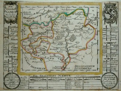
Belgium & Luxembourg
×