
Historical Maps
Far East & India
( Page 1 of 5 )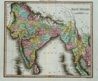
East Indies - Thomson 1820
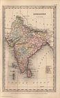
India - Starling 1831
Malaysia - Starling 1831
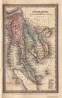
China & Japan - Starling 1831
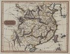
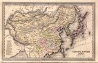
China - Findlay 1835
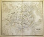
China - Johnston 1843
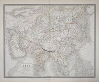
Asia Johnston 1843
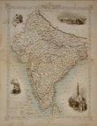
British India - Tallis 1850

£65 Pakistan Afghanistan - Tallis
Ref: a6031.36
Add to
basket
Thanks,Your Product Has Been Added To Basket

35x27 cm
CABOOL, | THE PUNJAB AND BELOOCHISTAN
Drawn and engraved on steel by J. Rapkin, this series of finely engraved maps were first published in parts from the end of the 1840's and issued as a complete volume, The Illustrated Atlas in 1851. The work was re-issued a number of times until about 1865 and the maps were then used by Montgomery Martin, the author of the text in the Illustrated Atlas, in his British Colonies from 1854. The final appearance of the maps, with vignettes erased from the plate, was in geographical dictionaries and encyclopaedias until about 1880.
This map showing Pakistan and part of Afghanistan, s from the The Illustrated Atlas of 1851 and includes vignettes of Lahore, Sultan Mahmoud's Minars and Fortress, Ghuznee and Boats on the Indus.
Small margins top and botttom with slight loss to decoration at top of title, some staining at bottom with loss to imprint. Otherwise a good example in original outline hand colour without centrefold.
Quick Links


Eastern Europe & Turkey

Asia
×