
Whole of Britain & British Isles
England & Wales
( Page 1 of 5 )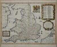
John Ogilby 1676

Saxon Heptarchy Robert Morden 1695
Robert Morden 1695
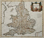
Herman Moll 1725
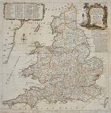
Thomas Kitchin 1763
John Cary 1809
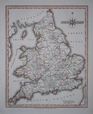
John Roper 1809
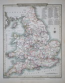
John Roper 1809


58x90 cm
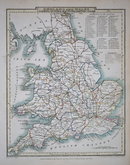
Pair of Maps:
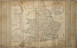
ENGLAND AND WALES (Northern sheet) | BY KEITH JOHNSTON. F.R.S.E.
ENGLAND AND WALES (Southern sheet) | BY KEITH JOHNSTON. F.R.S.E.
Pair of large, highly detailed lithographic printed map published in IRELAND | BY KEITH JOHNSTON. F.R.S.E.
Large, highly detailed lithographic printed map published in The Royal Atlas Of Modern Geography Exhibiting, in a series of entirely original and authentic maps, the present condition of geographical discovery and research in the several countries, empires, and states of the World by Alexander Keith Johnston geographer to the Queen for Scotland...William Blackwood & Sons Edinburgh and London MDCCCLXIX.
Overprinted in blue indicating rivers and sea information and hand coloured county boundaries boundaries.
Southern sheet has a few marks including 2 pink paint splashes.
Each map is 58x45cm
Price is for the 2 maps.
Quick Links


Scotland Maps

Wales Maps
×