
Scotland Maps
England & Wales
( Page 1 of 5 )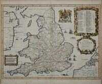
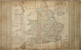
John Ogilby 1676

Saxon Heptarchy Robert Morden 1695
Robert Morden 1695
Herman Moll 1725
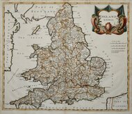
Thomas Kitchin 1763
John Cary 1809
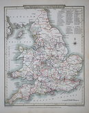
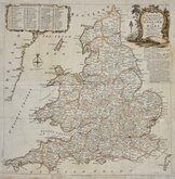
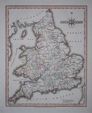
John Roper 1809
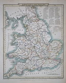
John Roper 1809


20x25 cm
ENGLAND AND WALES
FORMING AN INDEX MAP TO THE BRITISH ATLAS.
Drawn and Engraved under the direction of J. Britton & E. W. Brayley.
Engraved by J. Roper. | to accompany the Beauties of England and Wales.
London: Published for the Proprietors, by Vernor & Hood Poultry Septr. 1.1809.
Engraved by John Roper (1771-1810), a London engraver and copperplate printer trading from New Street Square from 1797 until his death in 1810. His widow, Mary Roper, continued the business at the same address until at least 1846. The cartographer has not been credited on this map but most in the series were drawn by George Cole. They were intended to accompany The Beauties of England and Wales but were not actually published with this work and were first issued in parts as a separate series between 1804 and 1810, first appearing in atlas form in The British Atlas published by Vernor Hood & Sharpe (& nine other publishers) in 1810. The maps were re-issued in several publications including Dugdale's Curiosities of Great Britain until 1843. Their final appearance was by lithographic transfer in Collins' railway and pedestrian atlas…Darton and Co. 1858.
This example of the map of England and Wales is the first printed state.
Good clean example in original hand colour
Quick Links


Wales Maps

Whole of Britain & British Isles
×