
Whole of Britain & British Isles
England & Wales
( Page 1 of 5 )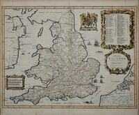
John Ogilby 1676

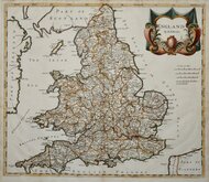
Saxon Heptarchy Robert Morden 1695
Robert Morden 1695
Herman Moll 1725
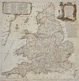
Thomas Kitchin 1763
John Cary 1809
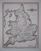
John Roper 1809
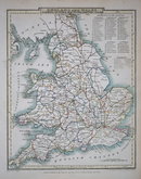
John Roper 1809


38x47 cm
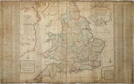
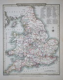
Map OF ENGLAND AND WALES Divided into Counties Shewing the Principal Roads, Railways, Canals & the Rivers, as far as they are NAVIGABLE.
DRAWN BY R. CREIGHTON. ENGRAVED BY THO.S STARLING.
London.
ENGRAVED FOR LEWIS'S TOPOGRAPHICAL DICTIONARY.
Drawn by Roger Creighton (1796-1838) draughtsman and surveyor. Born at Tynemouth, he is first recorded as a land-surveyor in Wakefield and perhaps trained under Christopher Greenwood with whom he worked on his series of county maps from 1818. He married Martha Gostling 16 Jan 1823 at St George Hanover Square and is variously recorded as draughtsman or surveyor on the baptismal records of their children between 1824 and 1834. He became the principal draughtsman for the Topographical Dictionary by Samuel Lewis. He was buried 9 April 1838 at St. Luke Chelsea
Engraved by Thomas Starling (1796-1850), draughtsman, engraver, printer, bookseller and publisher, born 24 Dec. 1796, son of Robert Starling and his wife Elizabeth Kearsley, and baptised at St. Mary Islington on 18th January 1797. Thomas had brothers in similar trades; Parlett Starling, printer, James Kearsley Starling, bookseller, and Matthew James Starling, engraver (mainly topographical views). Thomas was apprenticed (Stationers) in 1811. He married Ellen Smart at Mackworth, Derbyshire, 2nd November 1821. Declared bankrupt in 1824, he featured in a trial at The Old Bailey in 1828 when a canvasser, employed selling his plans of Islington, was prosecuted for embezzling the subscriptions. He was elected Fellow of the Royal Geographical Society on 23rd December 1833. Briefly imprisoned for debt in 1837, the 1841 Census describes him as an engraver living in Islington with his wife Ellen, schoolmistress, and three children. He died at Rochford, Essex, 15th June 1850.
First published in A Topographical dictionary of England… Samuel Lewis and Co. London 1831. With further issues until 1849.
Folds as issued. Short closed tear into left margin. Original outline colour.
Quick Links


Scotland Maps

Wales Maps
×