
Wales Maps
England & Wales
( Page 1 of 5 )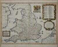
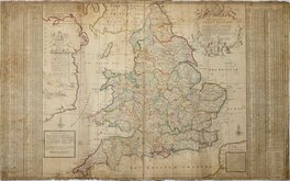
John Ogilby 1676

Saxon Heptarchy Robert Morden 1695
Robert Morden 1695
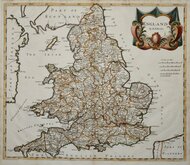
Herman Moll 1725
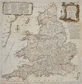
Thomas Kitchin 1763
John Cary 1809
John Roper 1809
John Roper 1809


33x39 cm
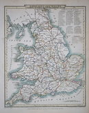
ENGLAND & WALES | BY J.& C.WALKER | Published by A. Fullarton & C.o Glasgow.
Engraved by brothers John & Charles Walker, engravers of the maps for Greenwood's Atlas of the Counties of England published 1834 and this series of maps, published in their British Atlas from 1837 were probably based on the same information.
Good hand coloured example. Folds as usual. Generous margins.
Quick Links


Whole of Britain & British Isles

Scotland Maps
×