
Whole of Britain & British Isles
England & Wales
( Page 1 of 5 )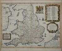
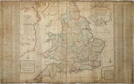
John Ogilby 1676

Saxon Heptarchy Robert Morden 1695
Robert Morden 1695
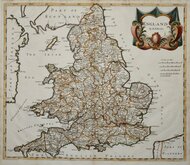
Herman Moll 1725
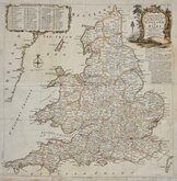
Thomas Kitchin 1763
John Cary 1809
John Roper 1809
John Roper 1809


43x54 cm
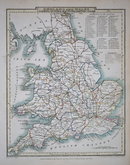
ENGLAND & WALES | BY G.H. SWANSTON EDIN.R | Printed by A & J. Macpherson, Royal Exchange, Edin.r | A.FULLARTON & C.O EDINBURGH, LONDON & DUBLIN.
Large double page fine engraved map in attractive original pastel hand colour. Published by Archibald Fullarton in his Royal Illustrated Atlas 1862.
Unfortunately there is some juvenile outlining in purple crayon to county boundaries at the Isle of Wight, part of Hampshire, the Severn estuary in Gloucestershire and part of Berkshire. There is also some creasing at the centrefold which is splitting and has been repaired with archival tape verso.
Quick Links


Scotland Maps

Wales Maps
×