
Staffordshire Maps
Cheshire Maps
( Page 3 of 3 )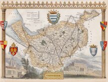
Thomas Moule 1837 [1845]
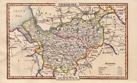
James Pigot 1839
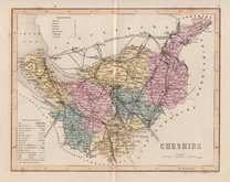
Joshua Archer 1842 [1860]
Edward Weller 1863 [1867]
William Hughes 1870
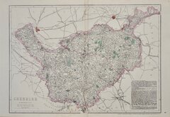
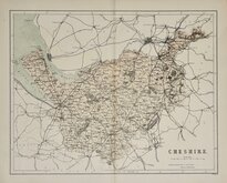
Francis Weller 1891
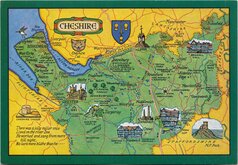
Cheshire Postcard 1980


28x22 cm
COLOUR PRINTED.
CHESHIRE
F.S.Weller, F.R.G.S.
WILLIAM MACKENZIE, LONDON EDINBURGH & GLASGOW.
Lithograph printed map from an engraving by Francis Sidney Weller (1849-1910), son of mapmaker Edward Weller, published by William Mackenzie in The Comprehensive Gazetteer of England and Wales issued in parts from c.1891-1895. The plate from which the lithograph was taken was not used for direct intaglio printing. The map is based on the New Series One Inch Ordnance Survey and has been overprinted in colours showing the county divided into the administrative units of Wirral, Eddibury, Northwich, crewe, Macclesfield, Knutsford, Altrincham, and Hyde.
Quick Links


Lancashire Maps

Road Maps
×