
Road Maps
Cambridgeshire Maps
( Page 1 of 4 )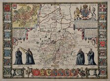
John Speed 1611
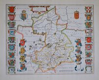
Jan Blaeu 1645
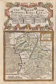
Owen & Bowen 1720
Thomas Badeslade 1741
George Bickham 1752
Robert Morden 1753
Joseph Ellis 1765
Thomas Read 1769


12x18 cm
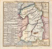
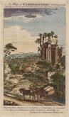
A MAP OF CAMBRIDGE SHIRE
Map set below the title cartouche for the road from London to Kings Lynn.
Engraved text descriptions alongside the county map and alongside and below the road map verso.
Engraved by Emanuel Bowen (1693?-1767) and published in the pocket road book Britannia Depicta by Thomas Bowles from 1720 to 1764. The county maps were based on Robert Morden's small series published in The New Description and State of England... from 1701.
Road map from Hull to Flamborough Head verso.
Good example in neat later hand colour.
For full description of the road, go to category: Maps > British Isles > Road Maps > Owen & Bowen.
Quick Links

Cambridgeshire Prints
Town Plans
×