
Berkshire Maps
Buckinghamshire Maps
( Page 3 of 4 )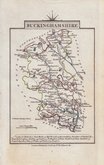
John Cary 1822
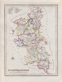
Roger Creighton 1831 [1840]
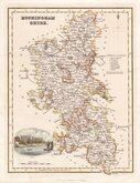
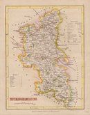
Gray & Son 1833
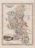
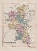
Gray & Son 1833 [1840]
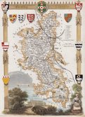
Thomas Moule 1837 [1844]
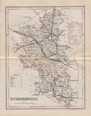
Joshua Archer 1842
Joshua Archer 1842 [1845]
Joshua Archer 1842 [1848]


9x15 cm
CARY'S MINIATURE SERIES.
BUCKINGHAMSHIRE
London. Published by G.& J.Cary. No.86 St.James's Str.
A re-engraved and revised version of of the map issued by John Cary in 1806 which in turn, was a re-engraved version of his 1789 map. All were issued under the title of Cary's Traveller's Companion, a highly successful work necessitating the re-engraving of worn plates to continue publication. This version was published with his brother George between 1822 and 1835. The final issue was by lithographic transfer in Crutchleys' Railroad Companion to England and Wales...in 1862.
Light fingermarking. Good example of the 1st state of the re-engraved plate in original hand colour.
Quick Links


Bedfordshire Maps

Road Maps
×