

British Isles
Atlantic & Poles
( Page 1 of 2 )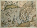
North Atlantic Ortelius 1608
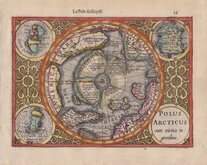
North Pole Mercator 1608
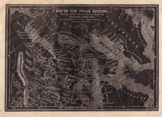
Polar Regions Archer 1833
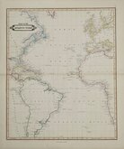
Atlantic by Lizars 1842
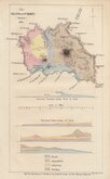
Santa Maria Azores Geological 1845
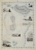
Atlantic Islands Tallis 1850
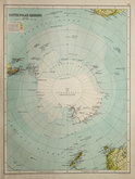
Antarctica by Bartholomew 1892
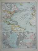
North Atlantic 1892


19x14 cm
POLUS ARTICUS cum vicinus regionibus.
Published in a French edition of the Mercator/Hondius Atlas Minor from 1608 to 1614.
The map is a reduced version of the second state of Gerard Mercator's SEPTENTRIONALIUM Terrarum published in 1606 and shows the North Pole as a mountain in the sea between four land masses. America and California, Northern Russia, Scandinavia, Iceland, and Greenland surround the map. Four roundels in the corners of the map contain the title, The Shetland Isles, Faeroe Islands , and the phantom island of Frisland.
Gerard Mercator (1512-1594), born Gerard de Cremere in Rupelmonde near Antwerp, is considered one of the most influential pioneers in cartography.
Jodocus Hondius (1563-1612) was a Flemish cartographer, engraver and publisher who purchased Mercator's plates and is best known for expanding and re-publishing Mercator's work.
A fine example in original colour. French typeset title above top border and French text verso.

×