

British Isles
Atlantic & Poles
( Page 1 of 2 )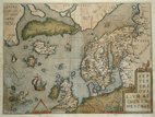
North Atlantic Ortelius 1608
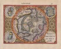
North Pole Mercator 1608
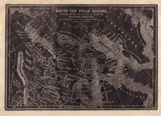
Polar Regions Archer 1833
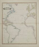
Atlantic by Lizars 1842
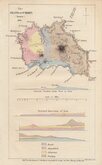
Santa Maria Azores Geological 1845
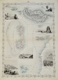
Atlantic Islands Tallis 1850
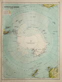
Antarctica by Bartholomew 1892
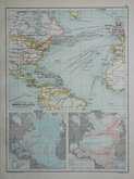
North Atlantic 1892


23x16 cm
MAP OF THE POLAR REGIONS, | Shewing all the Discoveries as made by | BRITISH OFFICERS, | including Ross, 1st.& 2nd.Voyage, Parry, 1st.2nd.3rd.voyage, | Franklin, Scoresby &c. | from | 1818 to 1833.
Woodblock printed engraving by Joshua Archer issued in the parts issue magazine Guide to Knowledge Edited by W Pinnock... published in January 1833.
Showing the north polar regions from Greenland to Alaska,
Repaired tear bottom left into printed map.

×