
England & Wales
Cornwall Maps
( Page 1 of 3 )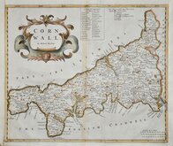
Robert Morden 1695
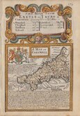
Emanuel Bowen 1720
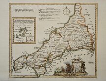
Thomas Kitchin 1749 [1769]
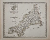
John Cary 1787 [1793]
Benjamin Baker 1791
Robert Butters 1803
Nathaniel Coltman 1806 [1809]
Sidney Hall 1820 [1834]


43x36 cm
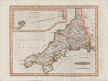
FIRST MAP OF THE COUNTY TO SHOW LONGITUDE FROM LONDON.
CORNWALL.
By Robert Morden.
Copper engraving produced by Robert Morden for publication in Edmund Gibson's translation of William Camden's Britannia first published by Abel Swalle and Awnsham & John Churchill in 1695. This is the first series of maps to mark longitude in minutes of time (top border) as well as in degrees (bottom border). For most counties, including Cornwall, longitude is based on the meridian of St. Paul's, London.
The work was republished in 1722, 1730, 1753 and, finally in 1772. The plate was updated for the 1722 edition, often only with changes to the spelling of some place names, and was reworked for the 1753 edition due to wear on the plate.
Small margins left and right with slight loss to border line lower right margin, both have been re-margined in matching paper with lower right border line redrawn. Some additional vertical creasing to centre of map and light toning at the centrefold.
First edition of 1695 in neat hand colour.
Quick Links


Sea Charts
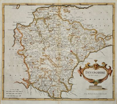
Devon Maps
×