
England & Wales
Cornwall Maps
( Page 1 of 3 )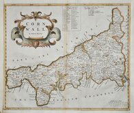
Robert Morden 1695
Emanuel Bowen 1720
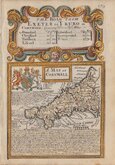
Thomas Kitchin 1749 [1769]
John Cary 1787 [1793]
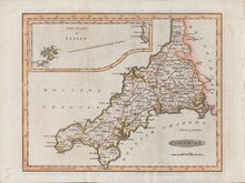
Benjamin Baker 1791
Robert Butters 1803
Nathaniel Coltman 1806 [1809]
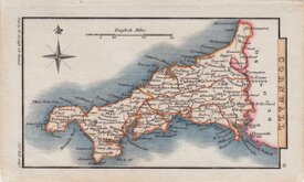
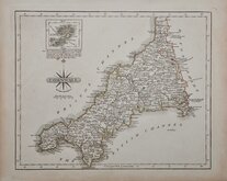
Sidney Hall 1820 [1834]


9x13 cm
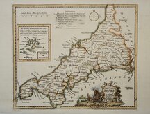
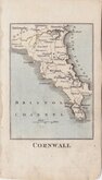
RARE "UPSIDE-DOWN' SERIES
CORNWALL.
The engraver or engravers of this series of maps are unknown. Robert Butters, a Fleet Street printer, issued them in An Atlas of England... in 1803. They are known as the "upside-down series" as many of the maps are engraved with North to the bottom of the page. In fact, the county maps are variously orientated with North to the top, left, right or bottom of the page. The work was possibly intended for school use and the odd orientation of the maps may have been done to appeal to young minds. This represented Robert Butters' only serious venture into cartography but unlike the huge success of John Cary's publication The Traveller's Companion, on which these maps were based, Butter's publication was limited to this single issue. John Hatchard acquired the plates later the same year issuing them in a two-volume work, The Picture of England 1803 and 1804. The publications were small and surviving examples are rare.
This map of Cornwall is without compass rose but oriented with North to the left. Some light marking here and there but still a good example of a rare map from the first edition of 1803 in original hand colour.
Quick Links

Devon Maps

Sea Charts
×