
Devon Maps
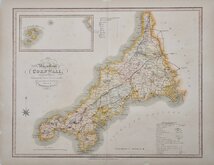
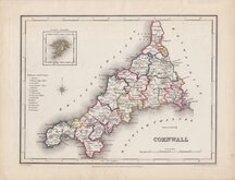
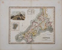
Cornwall Maps
( Page 2 of 3 )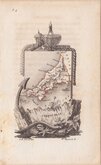
Aristide Perrot 1824
William Ebden 1824 [1835]
Roger Creighton 1831 [1845]
Robert Scott 1833 [1845]
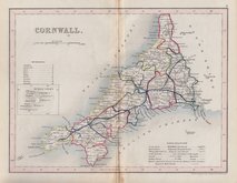
Joshua Archer 1842
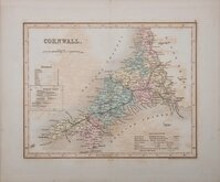
Joshua Archer 1842 [1858]
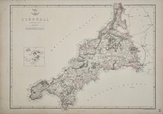
Edward Weller 1859 [1863]
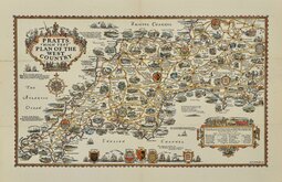
Alfred Taylor Pratts West Country 1932


6x11 cm
FRENCH MINIATURE MAP. SOMETIMES KNOWN AS THE "TOMBSTONE" MAPS.
CORNOUAILLE
A.M.Perrot del. | Me. Migneret Sc
Miniature map drawn by French Geographer Aristide Michel Perrot for publication in L'Angleterre, ou Description Historique et Topographique du Royaume Uni de la Grande Bretagne… by George Bernard Depping, a naturalised Frenchman of German birth. The map was engraved on copper by Parisian engraver, Madame Adrien Migneret.
The maps are surrounded by designs depicting the topography, industry and commerce asssociated with the county and have been affectionately termed ‘the tombstone series’.
An uncommon miniature map in original outline hand colour. Light offsetting from adjacent text page.
Quick Links

Sea Charts

England & Wales
×