
Herefordshire Maps
Worcestershire Maps
( Page 1 of 3 )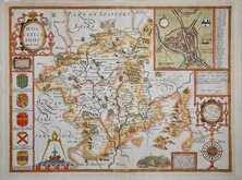
John Speed 1610 [1676]
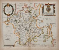
Richard Blome 1673
Robert Morden 1695
Emanuel Bowen 1720
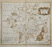
Emanuel Bowen 1756
Thomas Kitchin 1764
William Fowler 1765
John Haywood 1789


18x24 cm
ORIGINAL OUTLINE COLOUR DEPICTING THE POOR LAW UNIONS.
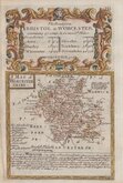
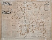
WORCESTERSHIRE
Drawn by R. Creighton. | T. Starling sculp London
DRAWN AND ENGRAVED FOR LEWIS' TOPOGRAPHICAL DICTIONARY.
Copper engraving by Thomas Starling (1796-1850) from a drawing by Roger Creighton (1796-1838) for publication in A Topographical dictionary of England… published by Samuel Lewis and Co. from 1831.The work achieved considerable success and was re-issued many times by Lewis until 1849. During this time the maps were amended and updated to include electoral information and the rapidly expanding railway network, with most counties known in at least six different states.
Good clean example in original outline hand colour. The colouring outlines the Poor Law Unions, created by the Poor Law Amendment act in 1834 which were in place from 1834 to 1930 for the administration of poor relief. This map, showing the Unions, was issued between 1842 and 1849.
Quick Links


Warwickshire Maps

Staffordshire Maps
×