
Herefordshire Maps
Worcestershire Maps
( Page 1 of 3 )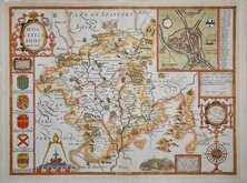
John Speed 1610 [1676]
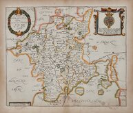
Richard Blome 1673
Robert Morden 1695
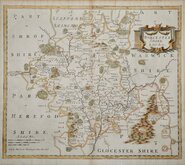
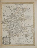
Emanuel Bowen 1720
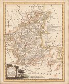
Emanuel Bowen 1756
Thomas Kitchin 1764
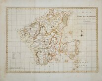
William Fowler 1765
John Haywood 1789


24x18 cm
ORIGINAL WASH HAND COLOUR.
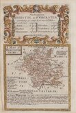
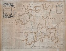
WORCESTERSHIRE
Drawn & Engraved by J. Archer, Pentonville London.
Drawn and engraved by Joshua Archer (1792-1863) for publication in Curiosities of Great Britain, England and Wales Delineated…by Thomas Dugdale.
The work was first published by L. Tallis in 1842 and was republished a number of times until 1860. The maps also appeared in The Universal English Dictionary…by the Rev. James Barclay and finally in Tallis's topographical dictionary of England & Wales in 1860.
A good example in full original hand colour from the 1860 edition of Dugdales Curiosities.
Quick Links


Warwickshire Maps

Staffordshire Maps
×