
Scotland Maps
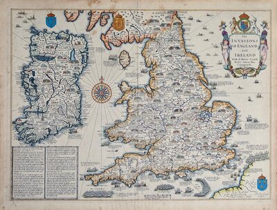
Whole of Britain & British Isles
( Page 1 of 2 )
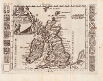
Roman Britain Robert Morden 1695
Daniel de la Feuille 1720
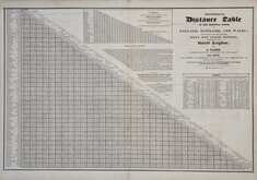
Pigot Distance Tables 1826
William Swire 1836
Hills of Britain 1842
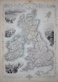
John Rapkin 1851
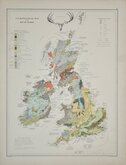
Palaeontological Johnston 1884
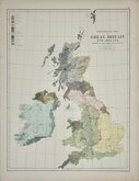
Ethnographic Johnston 1884

Request
Condition Report
RECIPROCAL Distance Table OF THE PRINCIPAL TOWNS IN ENGLAND, SCOTLAND, AND WALES ACCOMPANIED BY THE MOST ACCEPTED MAIL AND COACH ROUTES, THROUGHOUT THE UNITED KINGDOM; ALSO A TABLE , EXHIBITING THE DISTANCE OF ITS CHIEF SEA PORTS, FROM OTHERS OF IMPORTANCE AS TO TRADE AND COMMUNICATION IN FRANCE AND GERMANY; And another, showing the distance from LONDON (by Chart) th the Capitals of the Principal Countries in the WORLD.
Verso 6 tables;
ROUTES IN SCOTLAND. FROM EDINBURGH.
ROUTES IN IRELAND. FROM DUBLIN.
Route from the LAND'S END , in Cornwall, to JOHN O'GROATS' HOUSE, in the North of Scotland.
Tour from EDINBURGH to INVERNESS, by the Forts, and the celebrated Fall of Foyers.
ROUTES FROM LONDON.
PROVINCIAL ROUTES.
From Pigot's Directories published from 1826 to 1843. Good condition.
Quick Links

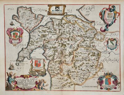
Wales Maps
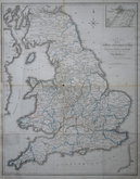
England & Wales
×