
England & Wales
Whole of Britain & British Isles
( Page 1 of 2 )
Roman Britain Robert Morden 1695
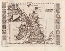
Daniel de la Feuille 1720

Hills of Britain 1842
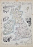
John Rapkin 1851
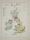
Palaeontological Johnston 1884
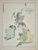
Ethnographic Johnston 1884
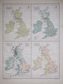
Products Population Rainfall Rivers 1892
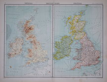
John Bartholomew 1898


25x36 cm
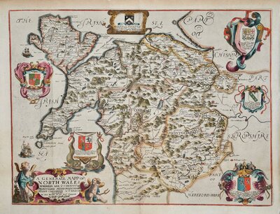
DECORATIVE MAP WITH FINE VIGNETTES
THE BRITISH ISLES
The Illustrations by John Salmon & Engraved by Rob.t Wallis. The Map Drawn and Engraved by J. Rapkin.
JOHN TALLIS AND COMPANY LONDON & NEW YORK.
Published in The Illustrated Atlas and Modern History of the World...Edited by R. Montgomery Martin Esq. by John Tallis and Company, London and New York 1851.
Vignettes of London, Edinburgh & Dublin
Original hand colour. No centrefold. Some staining to margins. Includes page of original typeset text description.
Quick Links


Scotland Maps
Wales Maps
×