
Folding Maps
Regional Maps of England & Wales
( Page 2 of 10 )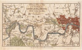
London Brentford 1792
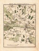
London to Bath Newbury 1792
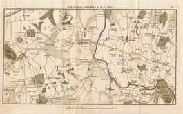
London to Bath Reading 1792
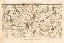
London to Bath Windsor Maidenhead 1792
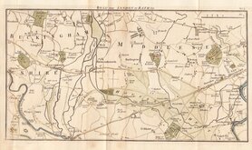
London to Bath Brentford Staines 1792
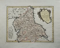
North England Joseph von Reilly 1799
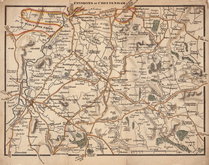
Environs of Cheltenham 1800
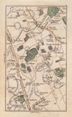
Elstree, Herts by Cary 1800

£90
Chapman & Andre Chapman & Andre Ref: 0581
Add to
basket
Thanks,Your Product Has Been Added To Basket

59x45 cm
Plate 1 from the twenty five plate large scale map of Essex by John Chapman and Peter André published in 1777.
Imprint: Publish'd as the Act directs Oc.t 1.st 1777. by John Chapman & Peter André.
The north west part of the county showing Great Chishall, Little Chishall, Heydon, Chrsihall, Elmdon, Strethall, Arkesden, Wickham Bonhunt, and Langley.
Good example in full original colour.
Quick Links


Road Maps

Town Plans
×