
Bedfordshire Maps
Huntingdonshire Maps
( Page 3 of 5 )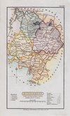
Henry Cooper 1808 [c.1825]
Samuel Neele 1815
Sidney Hall 1820
John Cary 1822
Aristide Perrot 1824
James Pigot 1826 [1839]
Roger Creighton 1831
Roger Creighton 1831 [c.1833]


16x20 cm
FINAL ISSUE. GOOD CLEAN MAP.
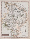
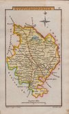
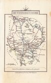
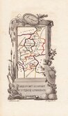
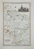
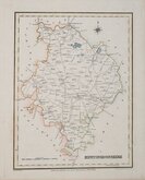
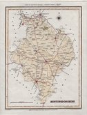
HUNTINGDONSHIRE
This series of maps were first issued in The English Traveller, published in parts by the Fleet Street printer Thomas Read, from November 1743, with Huntingdonshire appearing on 31st March 1744. Advertisements for the parts issues did not continue after September 1744 but, if the weekly publication was maintained, the work was completed in November 1745. The speed of production would have required the employment of several engravers but none have been identified.HUNTINGDONSHIRE
The complete three volume topographical work containing all the maps, The English Traveller…, was first issued in 1746.
On the death or retirement of Thomas Read, the maps passed into the hands of the Huguenot John Rocque (1704?-1762) who published them with revisions to most maps and with a further 19 maps, in The Small British Atlas… from 1753 to 1764. Their final appearance was in England Displayed…London: S.Bladon et.al...1769 and 1770.
This good clean hand coloured example, with the plate number erased, was published in England Displayed...London, 1769.
Quick Links


Northamptonshire Maps

Cambridgeshire Maps
×