
Northamptonshire Maps
Huntingdonshire Maps
( Page 1 of 5 )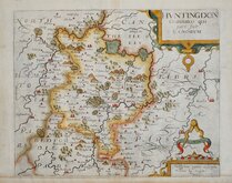
William Kip 1607 [1637]
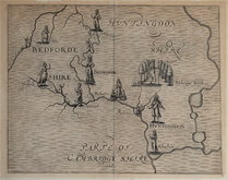
Michael Drayton 1622
Jan Blaeu 1645
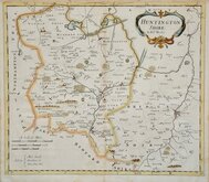
John Seller 1694 [c.1784]
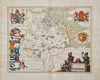
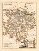
Robert Morden 1695
Owen & Bowen 1720
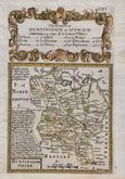
Thomas Read 1744 [1769]
Thomas Kitchin 1763


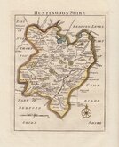
23x16 cm
SECOND STATE OF THE PLATE.
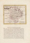
PLACE of ELECTION _ Huntingdon. _ POLLING PLACES { Huntingdon | Stilton
HUNTINGDONSHIRE
Drawn by R.Creighton. | T.Starling Sculp. Whittington Square London.
DRAWN AND ENGRAVED FOR LEWIS' TOPOGRAPHICAL DICTIONARY.
Copper engraving by Thomas Starling from a drawing by Roger Creighton issued in A Topographical dictionary of England… published by Samuel Lewis and Co. from 1831. The work achieved considerable success and was re-issued many times by Lewis until 1849. During this time the maps were amended and updated to include electoral information and the rapidly expanding railway network, with most counties known in at least six different states.
This map with the note outside top centre is the second state of the plate published in 1833 &1835. Later hand colour.
Quick Links


Bedfordshire Maps

Cambridgeshire Maps
×