
Folding Maps
Cartographic Miscellany
( Page 1 of 4 )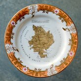
Coalport Map Plate 1835
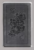
Ireland Cigarette Case 1960
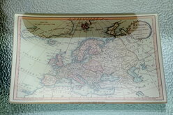
Glass Pin Tray
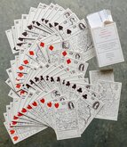
Morden's Playing Cards
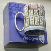
Wedgwood Mug Ogilby Road Map
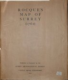
Rocques Map of Surrey 1931
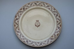
Little Amwell Golden Jubilee Plate 1887
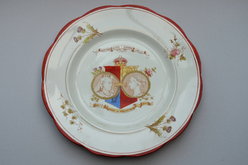
Hertford Heath Victorian Diamond Jubilee Plate 1897

Request
Condition Report
Facsimile of MORDEN'S PLAYING CARDS FIRST PUBLISHED 1676
Published by Harry Margary Lympne Castle Kent 1972
By happy coincidence the counties in England and Wales numbered fifty two, the same as a deck of playing cards. Further, the Welsh counties numbered 13 and could be represented in a single suit, the other three suits split the 39 English counties into northern, eastern, western counties.
The original pack of cards by Robert Morden followed shortly after the publication of John Ogilby's Britannia mapping the roads of England and Wales and Robert Morden included Ogilby's roads on these miniature playing card maps and was the first set of county maps to include roads.
Fine complete facsimile set in box with explanatory leaflet. Cards as new with only very light shelf wear to box.
Quick Links

Advertisements & Posters
×