
Antiquarian
Atlases & Road Books
( Page 1 of 4 )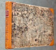
Gardner English Traveller
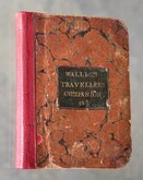
Wallis's Travellers Companion
Picture of England. Butters maps.
Ogilby Traveller's Guide 1712
Cox Magna Britannia Hertfordshire 1720
Magna Britannia Hertfordshire by Thomas Cox 1720
Senex Norden Speculum Middlesex & Hertfordshire 1723
Senex Norden Speculum Middlesex & Hertfordshire 1723


£350
Wallis Wallis 1812 [1814] Ref: 7006Tn
Add to
basket
Thanks,Your Product Has Been Added To Basket
Request
Condition Report
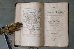
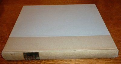
WALLIS'S New Pocket Edition of the ENGLISH COUNTIES or Travellers Companion in which are carefully laid Down all the DIRECT & CROSS ROADS, CITIES, Townes, villages, Parks, Seats, and Rivers with a General Map of England í Wales
London Published by J.WALLIS Engraver, Berwick St. Soho. and Sold by DAVIES & ELDRIDGE EXETER.
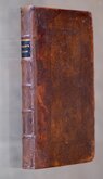
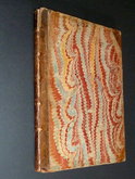
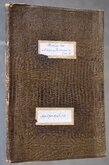
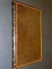
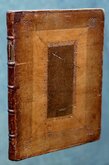
12mo. ( 11x14 cm.) Marbled boards with calf gilt lettered title to front board. Re-backed in red calf, new endpapers. Book plate of R.H.Johnstone to fixed front endpaper. Engraved title,. Address and contents. Engraved maps of England and Wales, 40 English counties, North and South Wales, The Isle of Wight (not called for), all full page except Yorkshire which is double page, printed one side only and in good original wash hand colour.
Covers a little bumped and worn, neatly re-backed. Contents generally clean with maps in good condition. Maps of Bucks, Cambs, Durham, Herts, Notts, Oxon, and Wilts are slightly shaved at right margin and Lincs is shaved at lower margin with loss of imprint (all as issued and not due to re-backing. In an effort to minimise the size of the work, small margins are common with this pocket atlas). Yorkshire with 3cm split at bottom centrefold.
All maps except England & Wales and Isle of Wight have a small plate number outside the border top right indicating the 2nd edition of Wallis's atlas.
Quick Links

General & Collectable
Map Books
×