
General & Collectable
Atlases & Road Books
( Page 1 of 4 )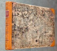
Gardner English Traveller
Wallis's Travellers Companion
Picture of England. Butters maps.
Ogilby Traveller's Guide 1712
Cox Magna Britannia Hertfordshire 1720
Magna Britannia Hertfordshire by Thomas Cox 1720
Senex Norden Speculum Middlesex & Hertfordshire 1723
Senex Norden Speculum Middlesex & Hertfordshire 1723


£3500
William Green J Hatchard 1804 Ref: 7008xmh5250
Add to
basket
Thanks,Your Product Has Been Added To Basket
Request
Condition Report
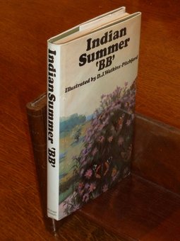
RARE ATLAS OF "UPSIDE-DOWN" MAPS BY ROBERT BUTTERS
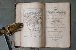
THE Picture of England
Illustrated with correct colour'd Maps of the several Counties.
In Two Volumes By William Green, A.B. AUTHOR OF The Spirit of English History, Plans of Economy &c.
Delectando, pariterque monendo.
LONDON: Printed for J. Hatchard, Bookseller to his MAJESTY, PICCADILLY 1804.
Price One Pound Four Shillings in Boards.
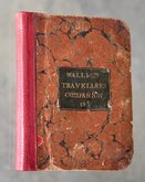
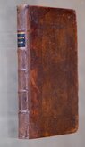
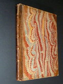
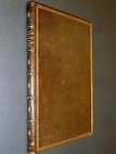
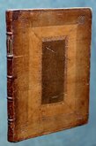
Two volumes, complete with the maps by Robert Butters known as "the upside-down series" though the maps are actually variously orientated.
Vol.1: Engraved frontispiece of Britannia. Title. Preface. 195 pages with 19 engraved and hand coloured un-numbered county maps (Beds to Leics) printed one side only within the text.
Vol.2 : Engraved and hand coloured map of England & Wales. Title. 248 pages with 21 engraved and hand coloured un-numbered county maps (Lancs to Yorks) printed one side only within the text.
Original half black morocco with marbled paper boards. Red labels with gilt titles and gilt tooled banding and volume numbers to spines. Book plate (Baron Clifford?) to front fixed endpaper each volume.
Professional repair to head and tail of spine each volume. Some wear to board edges and bumping to corners. Binding firm. Text pages uncut and most un-opened.
A very good copy of a very scarce work containing the county maps known as the "Upside-down series" by Robert Butters, the printer and publisher of the first work containing the maps, An Atlas of England... which appeared in 1803.
Quick Links
Map Books

Antiquarian
×