
Middlesex Maps
Surrey Maps
( Page 4 of 5 )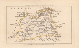
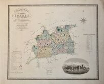
John Walker 1831
John Walker 1831 [c.1832]
Selina Hall 1833 [1852]
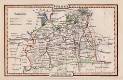
Robert Scott 1833 [c.1845]
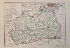
Christopher & John Greenwood 1834
James Pigot 1839 [1841]
Joshua Archer 1842 [1845]
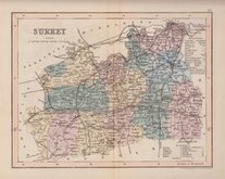
Benjamin Rees Davies 1863 [1867]


27x22 cm
UNUSUAL IMPRINT
For Malcolm's Agricultural Survey of Surry, Oct.1805.
SURRY By JOHN CARY Engraver.
Copper engraving by John Cary. This series of maps, commonly known as his "quarto" series, were published in Cary's New and Correct English Atlas and were justifiably popular, running to many editions from 1787 until about 1804. Re-engraved plates extended the life of the series from 1808 to 1843 and lithographic transfers from the plates by later publishers continued publication until about 1876 - a life of nearly 90 years.
Final state of the plate published in Cary's New and Correct English Atlas... London 1793 [actually issued1808].*
Original hand colour but with later red line to roads. Includes original page of typeset text description of the county with some near contemporary manuscript notes of the residents on the list of gentleman's seats.
*Although the imprint in the top border indicates publication in A Compendium of Modern Husbandry, principally written during a Survey of Surrey...by James Malcolm...London 1805., the original hand colouring is not the hand colouring used for Malcolm's work which indicated geology and soil types.
The map was published in Cary's New & Correct English Atlas, dated 1793 on the title page, actually published in 1808 and is accompanied by the original text page for this work.
Quick Links


Sussex Maps

Kent Maps
×