
Sussex Maps
Surrey Maps
( Page 2 of 5 )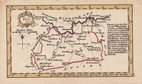
John Gibson 1759
Joseph Ellis 1765 [1773]
Antonio Zatta 1779
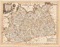
John Haywood 1788
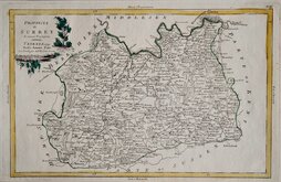
Cadell & Davies 1791
Benjamin Baker 1794 [1806]
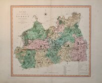
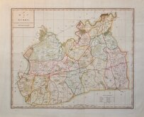
Charles Smith 1801
Robert Butters 1803


51x45 cm
FINE LARGE MAP IN BRIGHT ORIGINAL HAND COLOUR.
A NEW MAP of the COUNTY of SURREY Divided into Hundreds.
LONDON Printed for C.SMITH, No.172 Strand. January 6.th 1801.
Engraved by the firm of Jones and Smith, this series of large county maps were produced for Smith's New English Atlas being a complete set of County Maps, Divided into Hundreds...first published by C. Smith, London 1804. The maps were also issued separately from 1801. Charles Smith, was a stationer and map seller working from The Strand from 1800 to 1852. He was probably not related to the engraving firm of Smith and Jones. The publication of this work predated the publication of Cary's New English Atlas by 5 years and was very similar in size and style. This was the first series of county maps to show longitude measured from the Greenwich meridian.
Extra light vertical creases at centrefold but it remains a lovely example of the map of Surrey in bright original hand colour from the first issue of the map dated 1801, actually published in 1804.
Quick Links


Kent Maps

Middlesex Maps
×