
Sussex Maps
Surrey Maps
( Page 2 of 5 )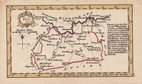
John Gibson 1759
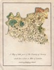
Joseph Ellis 1765 [1773]
Antonio Zatta 1779
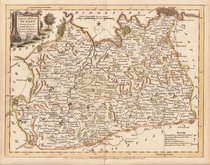
John Haywood 1788
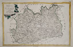
Cadell & Davies 1791
Benjamin Baker 1794 [1806]
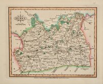
Charles Smith 1801
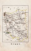
Robert Butters 1803


25x20 cm
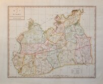
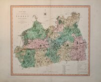
BY A FEMALE ENGRAVER DURING THE REIGNS OF WILLIAM IV AND QUEEN VICTORIA
SURREY. | ENGRAVED BY S. HALL
London, Published by Chapman & Hall 193 Piccadilly
This series of maps first appeared in Gorton's Topographical Dictionary issued in parts over a three year period from 1830, the complete work not published again after 1833. The maps were then issued in A New British Atlas…, Sidney Hall's British Atlas…, A Travelling County Atlas… and other variations on the title, from 1834 until c.1888. It's popularity due in part to the continuous updating of the plates to include the latest railways. The maps were intaglio printed until c.1858 and then by lithographic transfer.
It has been assumed that all the maps for this series were engraved by Sidney Hall (1788?-1831), but Hall married Selina Price (1780?-1853) in 1821 and his engraving business was continued by his wife after his death in 1831 who signed her maps "S.Hall.", whereas Sidney Hall usually signed his maps “Sid.yHall”. She was obviously a highly skilled engraver, presumably trained by her husband, and stylisticaly there seems to be little difference in their work. It is reasonable to assume that maps produced around the time of his death signed “S.Hall” are probably by Selinal. She is recorded as an engraver on the 1842 Census, living in Bury Street with a servant. She was buried 23 Nov. 1853 at St. George Bloomsbury. In her will, she left her books, maps etc., to her nephew Edward Weller who continued the business.
This example, in original outline hand colour, is from the 1852 edition entitled A Travelling County Atlas: with All the Railroads Accurately Laid Down and Coloured published by Chapman and Hall, 193 Piccadilly. (Late 186 Strand.)
Quick Links


Middlesex Maps

Kent Maps
×