
Worcestershire Maps
Staffordshire Maps
( Page 2 of 4 )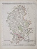
John Cary 1793 [1808]
William Yates 1798
Robert Butters 1803
George Cole 1808
George Cole 1808
John Cary 1809
Samuel John Neele 1812
Sidney Hall 1820


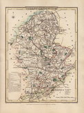
33x46 cm
LARGE CLEAR MAP. NEAT COLOURING.
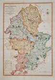
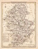
A MAP OF STAFFORDSHIRE, ENGRAVED FROM AN ACTUAL SURVEY; with Improvements.
Haywood del. | Sudlow Sc.
Engraved for J. Harrison, No. 115, Newgate Street, as the Act directs, July 25, 1788.
Drawn by John Haywood (fl.1781-1792) and engraved by Edward Sudlow (fl.1784-1793), this series of county maps were issued as loose sheet maps at erratic intervals over a four year period bearing dates between 1787 and 1789. They were first issued in atlas form in Maps Of The English Counties… in 1791 by John Harrison and remained on sale for several years. It seems that sales were disappointing as various reductions in price are recorded. Despite the claim in the title that the maps were from an actual survey, they were mostly based on the maps of Thomas Kitchin and Emanuel Bowen published in The Large English Atlas or one of the derivatives. The border is divided and numbered at 5' intervals with a graticule over the map.
Good hand coloured example. Small lower margin.
Quick Links


Derbyshire Maps
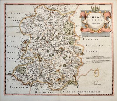
Shropshire Maps
×