
One Inch scale
Six Inch scale
( Page 1 of 25 )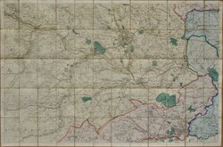
Halifax and Huddersfield 1854
Essex O S Index 1865
Parish Index Maps Hertfordshire 1880
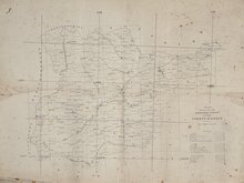
Parish Index Sheets Essex 1880
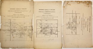
Parish Index Sheets Middlesex 1880
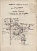
Index Plan Bishops Stortford 1880
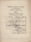
Index Plan Ware 1880
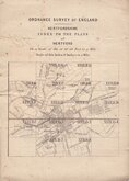
Index Plan Hertford 1880


50x38 cm
INDEX Shewing the State of the ORDNANCE SURVEY OF THE COUNTY OF ESSEX
Scale 4 Miles to an Inch
Uncommon working map with reference key for Detail Survey, Contouring and engraving. Map of Essex shows parishes, railways, major towns and grid reference for One Inch and Six Inch maps.
Scale 4 Miles to an Inch
No date. c. 1865
Closed tear left edge into map to Little Waltham. Folds and creases. Spotting.
Quick Links


Folding Maps
×