
John Cary
Roads by other Mapmakers
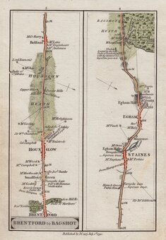
( Page 3 of 4 )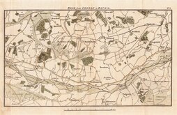
London to Bath Woolhampton Thatcham 1792
James Baker Kensington-Reading 1801
James Baker Stratford-Coventry 1801
James Baker Acton-Islip 1802
James Baker Acton-Islip 1802
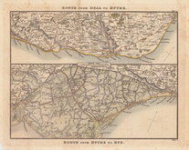
Dover & Romney 1826
Charles Smith Puckeridge-Kings Lynn 1826
Charles Smith London-Sheffield 1827

£40 London to Bath Woolhampton Thatcham
Ref: 6472.5
Add to
basket
Thanks,Your Product Has Been Added To Basket

27x17 cm
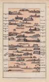
ROAD from LONDON to BATH &c. No.5.
The fifth plate from the series of eleven maps engraved for A Topographical Survey of the Great Road from London to Bath and Bristol...by Archibald Robertson. London, William Faden, 1792.
Archibald Robertson (fl.1777-1796) was a print-seller and drawing master trading from Saville Row and, from 1782, Charles Street St. James's Square. Robertson is known as a landscape painter and for his aquatints, his first aquatints were jointly published with well known watercolourist, Paul Sandby (c1731-1809). In the above work, the aquatint views are all unsigned but are almost certainly by Archibald Robertson. The maps are also unsigned by engraver or surveyor but Robertson is not known for surveying or line engraving.
An uncommon map of part of the road from London to Bristol showing Theale, Woolhampton, Thatcham, Brimpton, Aldermaston, Ufton Green, Sulhamstead Abbots, Englefield, Tidmarsh, Bradfield, Beenham, Bucklebury, Marlston Hermitage.
Folds and some light marking to margins and old repair verso to lower centrefold otherwise good in neat hand colour.
Quick Links

John Ogilby

Owen & Bowen
×