
John Ogilby
Roads by other Mapmakers
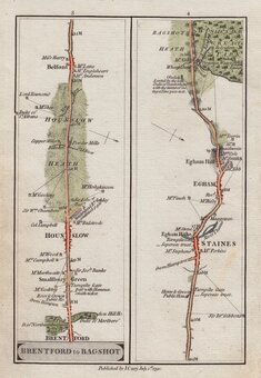
( Page 1 of 4 )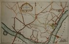
Westminster 1753
Paddington Islington 1756
Ipswich to Newmarket 1764
Ipswich Bury St. Edmunds 1764
London to Stilton 1767
London Aylesbury 1767
St Albans Oakham 1767
Darlaston Bridge to Berwick 1770

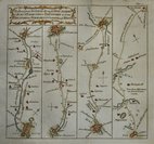
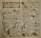
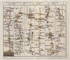
£70 Charles Smith Puckeridge-Kings Lynn
Ref: 6218tg
Add to
basket
Thanks,Your Product Has Been Added To Basket

9x16 cm
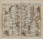
TO CAMBRIDGE | continued to Lynn | Burnham Market & Wells.
TO NEWMARKET | continued to Swaffam | Fakenham and Wells..
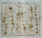
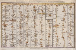
This road map was first published by Charles Smith & Son in Smith's New Pocket Companion to the Roads of England and Wales and Part of Scotland. Engraved on forty-three Copper-Plates...London 1826. There were two further issues in 1827 and 1830.
Despite the obvious merits of an up-to-date pocket road book it seems to have had little success, and surviving examples are rare today.
Quick Links


Owen & Bowen
John Cary
×