
Derbyshire Maps
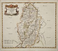
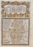
Nottinghamshire Maps
( Page 1 of 4 )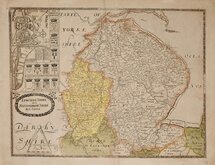
Christopher Saxton 1579 [1693]
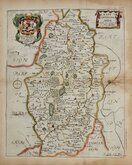
William Kip 1607
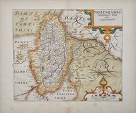
William Kip 1607 [1610]
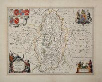
Jan Jansson 1646
Richard Blome 1673
Robert Morden 1695
Emanuel Bowen 1720
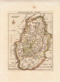
Thomas Read 1744 [1769]


32x27 cm
"SAXTON KIP" FIRST EDITION WITH LATIN TEXT VERSO.
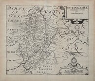
NOTINGAMIÆ
Comitatus olim pars CORITANORVM
Copper engraving by William Kip based on the map and survey by Christopher Saxton. This series of maps were produced to accompany William Camden's Britannia, first appearing in the 1607 Latin edition of the work. The maps were re-issued in the first English translation of Camden's Britannia in 1610 (twice) and one further issue in 1637. The maps were generally unchanged in all editions but the Latin edition included typeset text verso and a plate number was added to the corner of the maps in the second 1610 edition. There were no changes to the 1637 edition but later pulls from this edition are beginning to show signs of wear to the plate.
Very good dark impression from the first edition of 1607 with Latin text verso. Good margins but there is some loss to catchwords in the text margins verso.
Quick Links


Lincolnshire Maps

Leicestershire Maps
×