
Derbyshire Maps
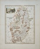
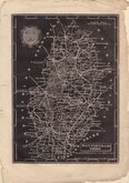
Nottinghamshire Maps
( Page 3 of 4 )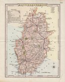
George Cole 1810 [1838]
Samuel John Neele 1818
Sidney Hall 1820
John Cary 1822
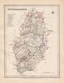
Roger Creighton 1831 [1845]
Robert Scott 1833
Joshua Archer 1833
Thomas Moule 1837 [1844]


18x24 cm
ORIGINAL HAND COLOUR SHOWING THE POOR LAW UNIONS.
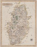
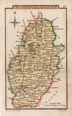
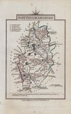
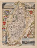
NOTTINGHAMSHIRE
Drawn by R. Creighton. | Engraved by J.& C. Walker.
DRAWN AND ENGRAVED FOR LEWIS' TOPOGRAPHICAL DICTIONARY.
Copper engraving by the firm of J & C Walker from a drawing by Roger Creighton (1796-1838) for publication in A Topographical dictionary of England… published by Samuel Lewis and Co. from 1831. The work achieved considerable success and was re-issued many times by Lewis until 1849. During this time the maps were amended and updated to include electoral information and the rapidly expanding railway network, with most counties known in at least six different states.
Good clean example in original outline hand colour. The colouring outlines the Poor Law Unions, created by the Poor Law Amendment act in 1834 which were in place from 1834 to 1930 for the administration of poor relief. This map, showing the Unions, was issued between 1842 and 1849.
Quick Links


Lincolnshire Maps

Leicestershire Maps
×