
Leicestershire Maps
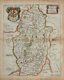
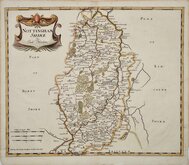
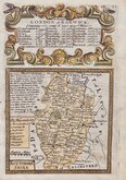
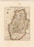
Nottinghamshire Maps
( Page 1 of 4 )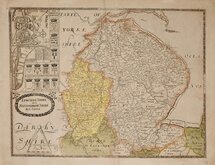
Christopher Saxton 1579 [1693]
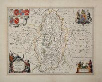
William Kip 1607
William Kip 1607 [1610]
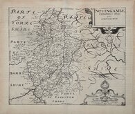
Jan Jansson 1646
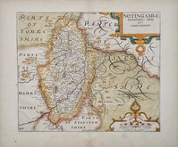
Richard Blome 1673
Robert Morden 1695
Emanuel Bowen 1720
Thomas Read 1744 [1769]


20x25 cm
NEAT HAND COLOUR.
NOTTINGHAMSHIRE.
Neele Sculpt. Strand.
Drawn and engraved by Samuel John Neele (1758-1824), this series were based on John Cary's 'quarto' maps of 1793. The early publication of this series is complex with loose issues and parts issues for many counties from about 1812. The first main publication containing the complete set of county maps was The New British Traveller; or, modern panorama of England and Wales...By James Dugdale... published about 1818 by J & J Cundee. The map appeared in three further issues under different titles in 1819 and 1820.
Good hand coloured example with reasonable margins for this series.
Quick Links


Lincolnshire Maps

Derbyshire Maps
×