
Leicestershire Maps
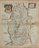
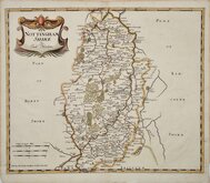
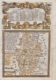
Nottinghamshire Maps
( Page 1 of 4 )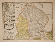
Christopher Saxton 1579 [1693]
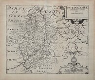
William Kip 1607
William Kip 1607 [1610]
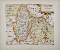
Jan Jansson 1646
Richard Blome 1673
Robert Morden 1695
Emanuel Bowen 1720
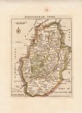
Thomas Read 1744 [1769]


17x15 cm
UNCOMMON. ALSO KNOWN AS "OSBORNE MAPS".
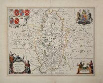
A Correct MAP of NOTTINGHAM SHIRE.
Copper engraving published in Geographia Magnae Britanniae… by Thomas Osborne, Andrew Millar, et.al. Although unsigned, the engraver was almost certainly Thomas Hutchinson (fl.1733-1754) who signed the maps of England and Wales and Gloucestershire in the same publication of uniformly engraved maps. Geogrphiae Magnae Brtanniae… was first published in 1748 and published only once more, with no changes to the maps, still dated 1748 but actually issued in 1756. The maps appeared in no other publication and are uncommon today.
This map of Nottingham has some archival tissue repairs to chipping at margins but remains a good hand coloured example of an uncommon map.
Quick Links


Derbyshire Maps

Lincolnshire Maps
×