
Owen & Bowen
Norfolk Maps
( Page 1 of 3 )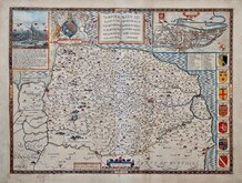
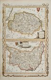
John Speed 1610 [1627]
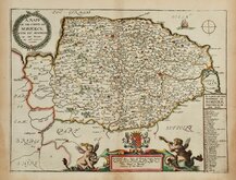
Richard Blome 1673
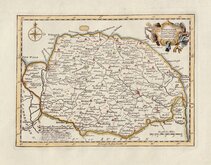
Robert Morden 1695
Emanuel Bowen 1720
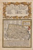
Thomas Read 1744 [1753]
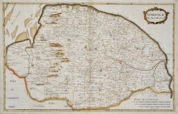
Thomas Kitchin 1750 [c.1786]
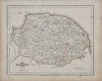
Thomas Conder 1784
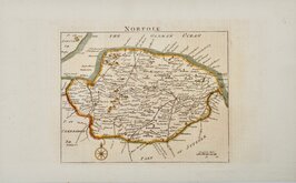
John Cary 1787 [1793]


27x22 cm
CARY'S "QUARTO" SERIES. INCLUDES TEXT PAGE.
NORFOLK
BY JOHN CARY Engraver.
London: Published by J. Cary, Engraver & Map Seller No. 181 Strand. July 1.1809.
Copper engraving by John Cary. This series of maps, commonly known as his "quarto" series, published in Cary's New and Correct English Atlas, were justifiably popular and ran to many editions from 1787 until about 1804 with re-engraved plates extending the life of the series from 1808 to 1843 and lithographic transfers by later publishers continuing until about 1876 - a life of nearly 90 years.
This example is from the re-engraved plate of 1809, most plates were dated 1793 as they replaced the worn plates from the work but on completion were re-dated to 1809. The paper bears a dated watermark of 1808. Original hand colour. Fine condition with separate original printed page of text description of the county.
Ref. Raymond Frostick The Printed Maps of Norfolk [74.1]
Quick Links


Cambridgeshire Maps

England & Wales
×