
England & Wales
Norfolk Maps
( Page 1 of 3 )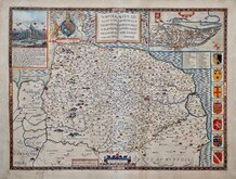
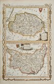
John Speed 1610 [1627]
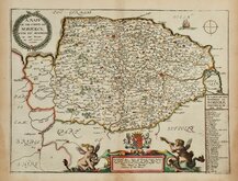
Richard Blome 1673
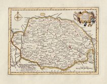
Robert Morden 1695
Emanuel Bowen 1720
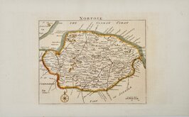
Thomas Read 1744 [1753]
Thomas Kitchin 1750 [c.1786]
Thomas Conder 1784
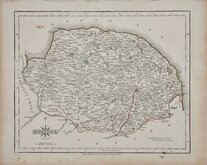
John Cary 1787 [1793]


51x38 cm
GEORGE HUMBLE EDITION
NORFOLK A COUNTIE FLORISHING & POPULOUS DESCRIBED AND DEVIDED WITH THE ARMES OF SUCH NOBLE FAMILIES AS HAVE BORNE THE TITLES THEROF.
Discribed by Christopher Saxton. Augmented by I. Speede. Are to be sold in popes head Alley by J.S. & G.H. cum privil.
R: Elstrack sculpsit.
John Speed (1552-1629), born in Cheshire, was a Tailor, becoming a member of the Worshipful Company of Merchant Taylors in 1580. He became interested in History and antiquities and became a member of the Society of Antiquaries and friend of William Camden. In 1611 he published his History of Great Britaine followed by his Theatre of the Empire of Great Britaine the following year. The Theatre was designed as the topographical section to his History and the inclusion of county maps with inset town plans has ensured Speed's name will be remembered. The maps were designed and engraved by Jodocus Hondius in Amsterdam from materials and instructions sent to him by Speed. Speed's main cartographical contribution was the town plans, Speed claiming authorship to those that include a scale of paces "by mine owne travails". The county maps are based on the surveys of Christopher Saxton and John Norden. The inclusion of the internal administrative divisions of the counties was a new innovation by Speed perpetuated in most county maps that followed for the next 300 years. The descriptive text on the back of the maps is taken from Camden and as the text had to be re-set for each issue enables us to date an individual map. On 29th April 1608 George Humble obtained the rights to print and sell the atlas for 21 years but publication did not actually start until 1611. Publication of John Speed's maps continued by various publishers until at least 1770, a publication period of 160 years.
Town Plan of Norwich, battle scene, six armorials of Norfolk nobility, and Royal arms.
This Norfolk plate underwent a number of changes during publication. This example includes the engraver's signature, R. Elstrack, and the battle scene re-engraved on a separate small plate inserted into the corner of the main plate, presumably to replace damage, dating it as the 1627 edition published by John Humble.
Reynold Elstrack (1571-1630?) engraver, was born in London to Flemish émigrés. He engraved John Speed's wall map of Britain of c.1603 and his map of Canaan, but this Norfolk map is the only map from Speed's Theatre to bear his name.
Hand coloured. Some additional creasing. Old repair to left bottom border in matching paper outside plate mark otherwise good margins.
The inset plate of the battle scene replacing the damaged area the is smaller than the cut-out made to receive it and was not fixed to the main plate but laid loosely into the cut-out in the rolling press often resulting in an unsightly misalignment, but this example has been well aligned.
Raymond Frostick Printed Maps of Norfolk ref. [8.4]
Quick Links


Cambridgeshire Maps

Owen & Bowen
×