
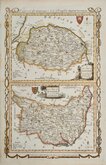
Cambridgeshire Maps
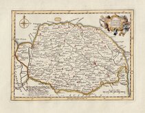
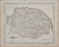
Norfolk Maps
( Page 1 of 3 )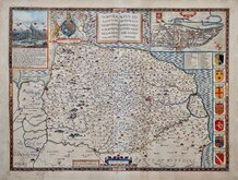
John Speed 1610 [1627]
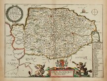
Richard Blome 1673
Robert Morden 1695
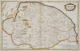
Emanuel Bowen 1720
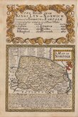
Thomas Read 1744 [1753]
Thomas Kitchin 1750 [c.1786]
Thomas Conder 1784
John Cary 1787 [1793]


25x19 cm
LINE & WASH HAND COLOUR TO THE HUNDREDS.
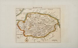
NORFOLK.
Pub.d by Arch.d Fullarton & C.o
Steel engraving by Gray & Son first published in Bell's New and Comprehensive Gazetteer in 1833.
The text for the gazetteer was largely copied from Lewis' Topographical Dictionary of 1831 and in 1839 Lewis obtained an injunction against Bell for plagiarism and the work was withdrawn. Archibald Fullarton, the publisher of Bell's Gazetteer republished the maps with new text in The Parliamentary Gazetteer from 1840 until 1849. Most of the maps were also copied from those in an earlier topographical dictionary, the maps by Sidney Hall prepared for John Gorton's Topographical Dictionary of Great Britain and Ireland published in 1831 as a rival to Lewis' work.
Robert Gray (1771?-1848) Scottish engraver, lithographer and copperplate printer trading from Glasgow as "Gray & Todd" 1804-1856 and as "Gray & Son" 1825-1848, initially with his son John, and later with his son James who continued the business after Robert Gray's death until at least 1856.
This example, with the indication of the proposed Eastern Counties Railway to Norwich and Great Yarmouth, Gray's imprint removed and the revised imprint of Fullarton & Co., is from the 1845 edition of The Parliamentary Gazetteer.
Good example in full hand colour. Generous margins.
Ref, Printed Maps of Norfolk Raymond Frostick [111.Post 1840].
Quick Links


England & Wales

Owen & Bowen
×