
Owen & Bowen
Norfolk Maps
( Page 1 of 3 )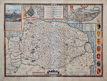
John Speed 1610 [1627]
Richard Blome 1673
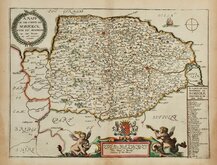
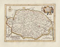
Robert Morden 1695
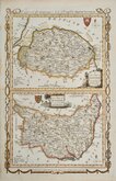
Emanuel Bowen 1720
Thomas Read 1744 [1753]
Thomas Kitchin 1750 [c.1786]
Thomas Conder 1784
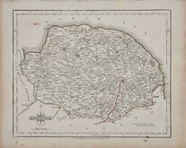
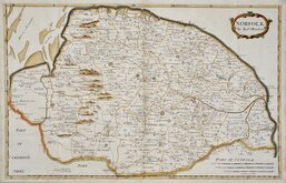
John Cary 1787 [1793]


24x18 cm
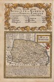
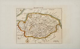
"COLE & ROPER"
NORFOLK
Engraved by John Roper (1771-1810), a London engraver and copperplate printer trading from New Street Square from 1797 until his death in 1810. His widow, Mary Roper, continued the business at the same address until at least 1846. This series of maps, most drawn by George Cole, were intended to accompany The Beauties of England and Wales. The maps were not actually published with this work but first issued in parts as a separate series between 1804 and 1810 and first appearing in atlas form in The British Atlas published by Vernor Hood & Sharpe & nine other publishers in 1810. The maps were re-issued in several publications including Dugdale's Curiosities of Great Britain until 1843. Their final appearance was by lithographic transfer in Collins' railway and pedestrian atlas… published by Darton and Co. in 1858.
This example of the map of Norfolk, with the addition of polling places and the Eastern & Western Divisions, is from 1835 issue of Dugdale's Curiosities.
Some stitch holes at centrefold, otherwise good.
Ref. Raymond Frostick The Printed Maps of Norfolk [71.5]
Quick Links


England & Wales

Cambridgeshire Maps
×