
Cambridgeshire Maps
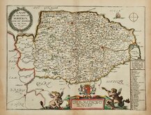
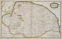
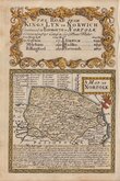
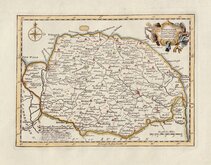
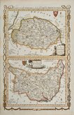
Norfolk Maps
( Page 1 of 3 )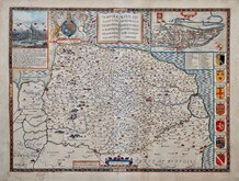
John Speed 1610 [1627]
Richard Blome 1673
Robert Morden 1695
Emanuel Bowen 1720
Thomas Read 1744 [1753]
Thomas Kitchin 1750 [c.1786]
Thomas Conder 1784
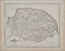
John Cary 1787 [1793]


15x9 cm
CARY'S MINIATURE SERIES.
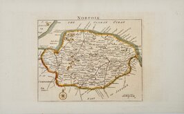
NORFOLK
London. Published by G.& J.Cary No. 86 St. James's Str.
This is a re-engraved and revised version of of the map issued by John Cary in 1806 which in turn, was a re-engraved version of his 1789 map. All were issued under the title of Cary's Traveller's Companion, a highly successful work necessitating the re-engraving of worn plates to continue publication. This edition, published with his brother, George, between 1822 and 1828, is the only version with placenames on the map engraved to read with North at the top, the title, list of placenames and distances, and the imprint being engraved sideways.
Some finger marking at edges but still a good example in original hand colour with generous margins.
Ref. Raymond Frostick The Printed Maps of Norfolk [91.1]
Quick Links


England & Wales

Owen & Bowen
×