
Owen & Bowen
Norfolk Maps
( Page 1 of 3 )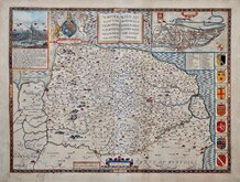
John Speed 1610 [1627]
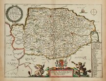
Richard Blome 1673
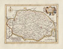
Robert Morden 1695
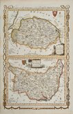
Emanuel Bowen 1720
Thomas Read 1744 [1753]
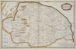
Thomas Kitchin 1750 [c.1786]
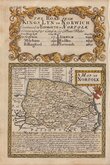
Thomas Conder 1784
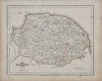
John Cary 1787 [1793]


11x13 cm
ORIGINAL WASH COLOUR.
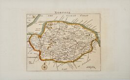
NORFOLK
Copper engraving first published in parts county by county in A Topographical and statistical description of the county of…by George Alexander Cooke…Illustrated with a map of the county. London, C. Cooke 1808.
Further publications by Cooke followed under titles; The Modern British Traveller… & Topography of Great Britain… in 1810 & 1822. The maps were next issued, with plate numbers added, in Gray’s New Book of the Roads…by George Carrington Gray London, Sherwood, Jones and Co., 1824. Their final appearance was a republication of the first issue, London, Sherwood, Gilbert and Piper, “printed by assignment from the executors of the late C. Cooke”.
The Norfolk map was re-engraved for the 1822 edition with North to the top of the page.
This fine example in original wash hand colour, is the re-engraved version issued from 1822 in Topography of Great Britain..., in 1824 in Gray’s New Book of the Roads…, and from 1826 to about 1831 in issues of A topographical and statistical description of the county of Norfolk.
Ref. Raymond Frostick The Printed Maps of Norfolk [93.1]
Quick Links


Cambridgeshire Maps

England & Wales
×