
Mediterranean
Historical Maps
( Page 3 of 10 )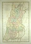
Canaan 1798
Eastern Mediterranean 1800
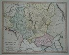
Samartia 1801
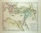
Imperium Parthicum 1807
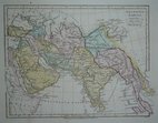
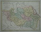
Orientis Tabula 1807
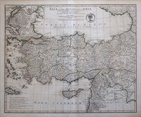
Asia Minor 1821
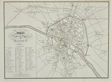
Paris 1824
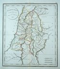
Israel 1825

£15 Preston Rebellion General Wills
Ref: m7621
Add to
basket
Thanks,Your Product Has Been Added To Basket

25x21 cm
[TH]E REBELLION HAPPILY SUPRESSED AT PRESTON BY GENERAL WILLS
A MAP and PLAN of the TOWN of PRESTON. with the Batteries and Barricades of the REBELS And The ATTACKS of The KINGS FORCES. Commanded by General WILLS.
TO THE IMMORTAL FAME OF _GENERAL WILLS_ This Plate is dedicated by his humbe Serv.t A. Boyer.
The above is an exact copy of an old Plan of the town of Preston &c. in 1715. _ Done by Charles St. Clare, 1818.
FISHER, SON, & CO. LONDON 1836.
Published in Lancashire Illustrated... Fisher, Son & Co. London 1836.
Some creasing.
Quick Links


Road Maps

Europe
×