
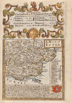
Essex Maps
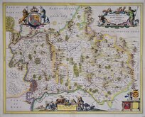
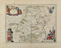
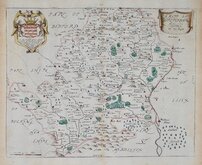
Hertfordshire Maps
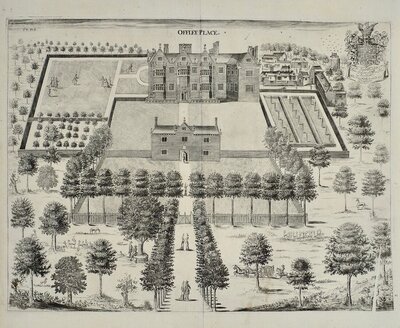
( Page 1 of 11 )
William Kip 1610

John Speed 1614

John Speed Original Colour 1616

Jan Jansson 1646
Jan Jansson 1646

Pieter Keere 1646
Jan Blaeu 1662
Richard Blome 1673


66x53 cm
A New Improved MAP | OF | HARTFORDSHIRE | from the Best | SURVEYS & INTELLIGENCE, | Divided into its | HUNDREDS; | Shewing the Several ROADS, & | true Measured Distances | between Town & Town. | ALSO | the Rectories & Vicarages; the | Parks and Seats of | Nobility and Gentry; | with other useful Particulars | By Thos: Kitchin, | Geographer.
Printed for Robt. Sayer in Fleet Street, Jphn Bowles in Cornhil, & Carington Bowles in St. Pauls Church Yard.
Copper engraving by Thomas Kitchin published in The Large English Atlas from 1760. The work was the first large scale atlas of English counties since the works of Blaeu and Jansson a century earlier and was based on the latest surveys available (most maps at this time were still based on those of Speed and Saxton, their plates being still in use). The maps were a long time in preparation, beginning in 1749 with the county of Sussex and reaching completion of 45 plates in 1760. The engraving work was mostly shared between Thomas Kitchin and Emanuel Bowen. During this time the plates passed through the hands of several publishers and were issued individually and in part works without title. The Large English Atlas was issued by various publishers until c.1794 with few changes to the maps. Only the publishers imprint and plate number enable us to identify the edition.
The Hertfordshire plate is based on the survey carried out by Payler Smith for the large map of the counties of Middlesex, Hertfordshire and Essex published by John Warburton, Joseph Bland and Payler Smith c.1724.
This example, with the imprint of Robt. Sayer, John and Carington Bowles was published from 1765 to 1780. Original outline hand colour to the map withl later hand colour to decorative elements. Some browing from an old mount outside the plate mark and some overall toning verso. Archival tape to short centrefold splits verso just reaching map edge top & bottom, otherwise undamaged. Good margins all round.
Hodson Printed Maps of Hertfordshire ref. 36(v)
Quick Links
Hertfordshire Prints

Middlesex Maps
×