
Middlesex Maps
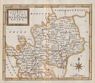
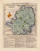
Hertfordshire Maps
( Page 3 of 11 )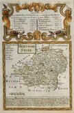
Emanuel Bowen 1720
Warburton Bland & Smyth 1726
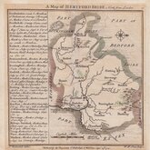
Thomas Badeslade 1742
John Cowley 1744
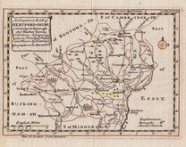
Thomas Read 1744 [1753]
Thomas Hutchinson 1748
Thomas Kitchin 1748 [c.1786]
Thomas Jefferys & Thomas Kitchin 1749 [c.1775]


8x12 cm
"OWEN & BOWEN"
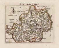
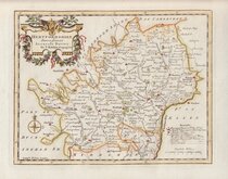
HERTFORD SHIRE
Map set below a decorative cartouche containing the title and details of the road from London to Norwich commencing at Puckeridge.
Road map of the first part of the route from Puckeridge to Norwich verso.
Engraved text descriptions below the county map and alongside and below the road map verso.
Engraved by Emanuel Bowen (1693?-1767) and published in the pocket road bookBritannia Depicta by Thomas Bowles from 1720 to 1764. The county maps were based on Robert Morden's small series published in The New Description and State of England... from 1701. Text descriptions compiled by John Owen.
Small wrinkle at top edge, a good example in fine hand colour both sides.
Mount option at checkout is for a conservation window mount both sdes.
For full description of the road, go to category: Maps > British Isles > RoadMaps > Owen & Bowen.
Hodson Printed Maps of Hertfordshire ref. 24(i)
SPECIAL OFFER MOUNT OPTION AVAILABLE AT CHECKOUT FOR UK POSTAGE
Quick Links


Essex Maps

Hertfordshire Prints
×