
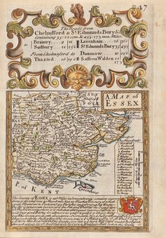
Essex Maps
Hertfordshire Maps
( Page 1 of 11 )
William Kip 1610

John Speed 1614

John Speed Original Colour 1616

Jan Jansson 1646
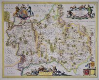
Jan Jansson 1646

Pieter Keere 1646
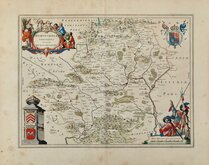
Jan Blaeu 1662
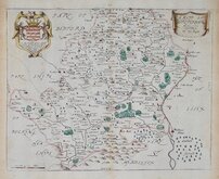
Richard Blome 1673


6.5 dia. cm
HERTFORDSHIRE
Sold by J.Luffman 28 Little Bell Alley, Coleman Str.t London.
Miniature circular copper engraved map by John Luffman published in a geographical text book entitled A New Pocket Atlas and Geography of England and Wales.
There were only three issues of this work, two by John Luffman in 1803 and one in 1806 published by Lackington Allen and Co. who seem to have taken over the publication. The Hertfordshire plate is known in two states, the only dfference being the position of the plate number 16 above the map, which was moved closer the map border in the second state. This example is the second state published in 1803 or 1806.
The map was originally printed with a typeset text description of the county below but this example has been trimmed around the map and fitted within a circular glass paperweight. The map itself is undamged and could easily be set in a frame with a circular mount for a more traditional display.
Hodson Printed Maps of Hertfordshire ref. 61(ii)
Quick Links

Middlesex Maps
Hertfordshire Prints
×