
Middlesex Maps
Hertfordshire Maps
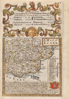
( Page 1 of 11 )
William Kip 1610

John Speed 1614

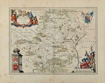
John Speed Original Colour 1616

Jan Jansson 1646
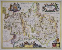
Jan Jansson 1646

Pieter Keere 1646
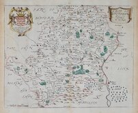
Jan Blaeu 1662
Richard Blome 1673


48x37 cm
The County of HERTFORD. With additions & Corrected and amended in many Places.
H.Moll Fecit A.o 1700.
Copper engraving by Herman Moll (1654?-1732) for publication in The Historical Antiquities of Hertfordshire...Illustrated with a large map of the county...by Sir Henry Chauncy, Kt. Serjeant at Law...London: Ben Griffin, et.al. 1700. A close copy of the map, drawn on stone and printed by lithography, was made for the second issue of Chauncy's work in 1826. This finely engraved and detailed map, based on John Oliver's map of 1695 with longitude from Robert Morden's map, also of 1695, appeared in the single issue of 1700 and no other work.
Little is known about the private life of Herman Moll but his output as an engraver, cartographer, mapseller and globemaker was considerable. Born in Germany about 1654 he is first recorded in London in 1678 producing maps for Moses Pitt's English Atlas. He married Ann Magdalen sometime before 1686 and a son, Gillis Hendrick Moll was baptised at St. Anne, Blackfriars in that year. He worked from addresses in Blackfriars, Charing Cross, and The Strand until his death on 22nd September 1732. His will left all his goods and etates in "Great Brittaine and Germany or elsewhere" to his daughter Henderina Amelia Moll. There was no mention in the will of maps or plates but most came into the hands of John Bowles and Thomas Bowles.
Remargined bottom border and some light creasing but it remains a very good example of a fine, uncommon map in good hand colour.
Hodson Printed Maps of Hertfordshire ref. 21
Quick Links

Hertfordshire Prints
Essex Maps
×